The islands of the Azores are a hikers paradise and Ilha Verde (the green island) is no exception.
There are trails that lead to pristine, remote beaches while others course through dense jungle like settings that suddenly open up to breathtaking crater lakes. One of our more challenging hikes took us to the highest elevation on the island with 360 degree views of the ocean, seaside villages and the distant island of Santa Maria.
There are trails to suit every level of enthusiast, from an afternoon hike on cliffs high above the ocean to calf burners that will test the stamina of even the most ambitious hiker.
Among the many adventures that we enjoyed during our year-long stay, here are our top 5 hikes of Sao Miguel, all of which we experienced without the need for a tour company.
Praia to Lagoa do Fogo trail l 2.25
37.7500° N, 25.4667° W
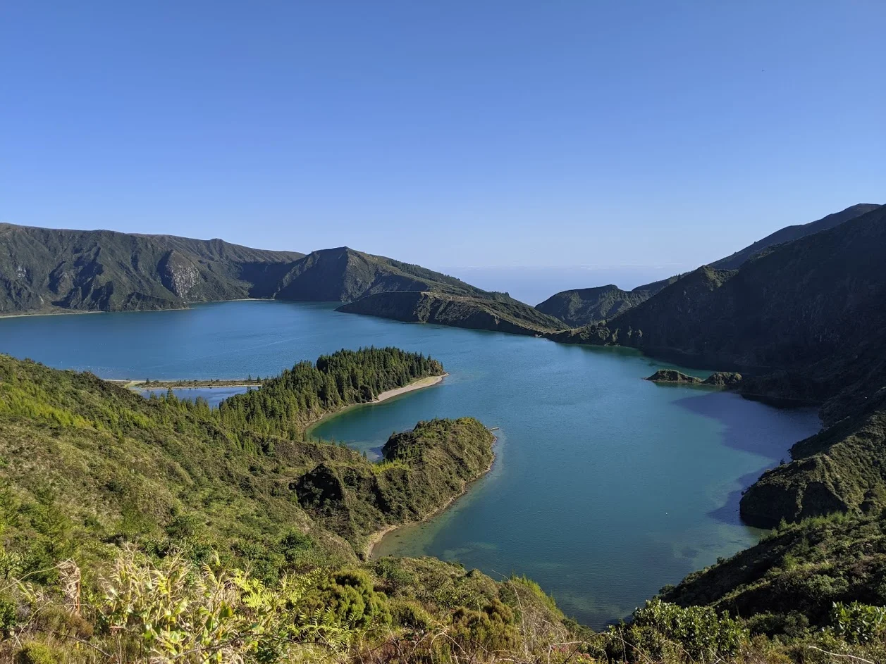
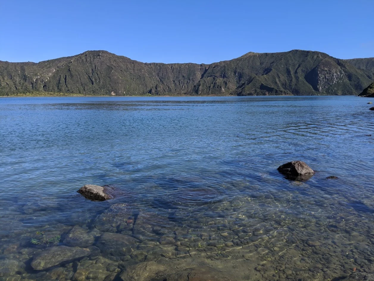
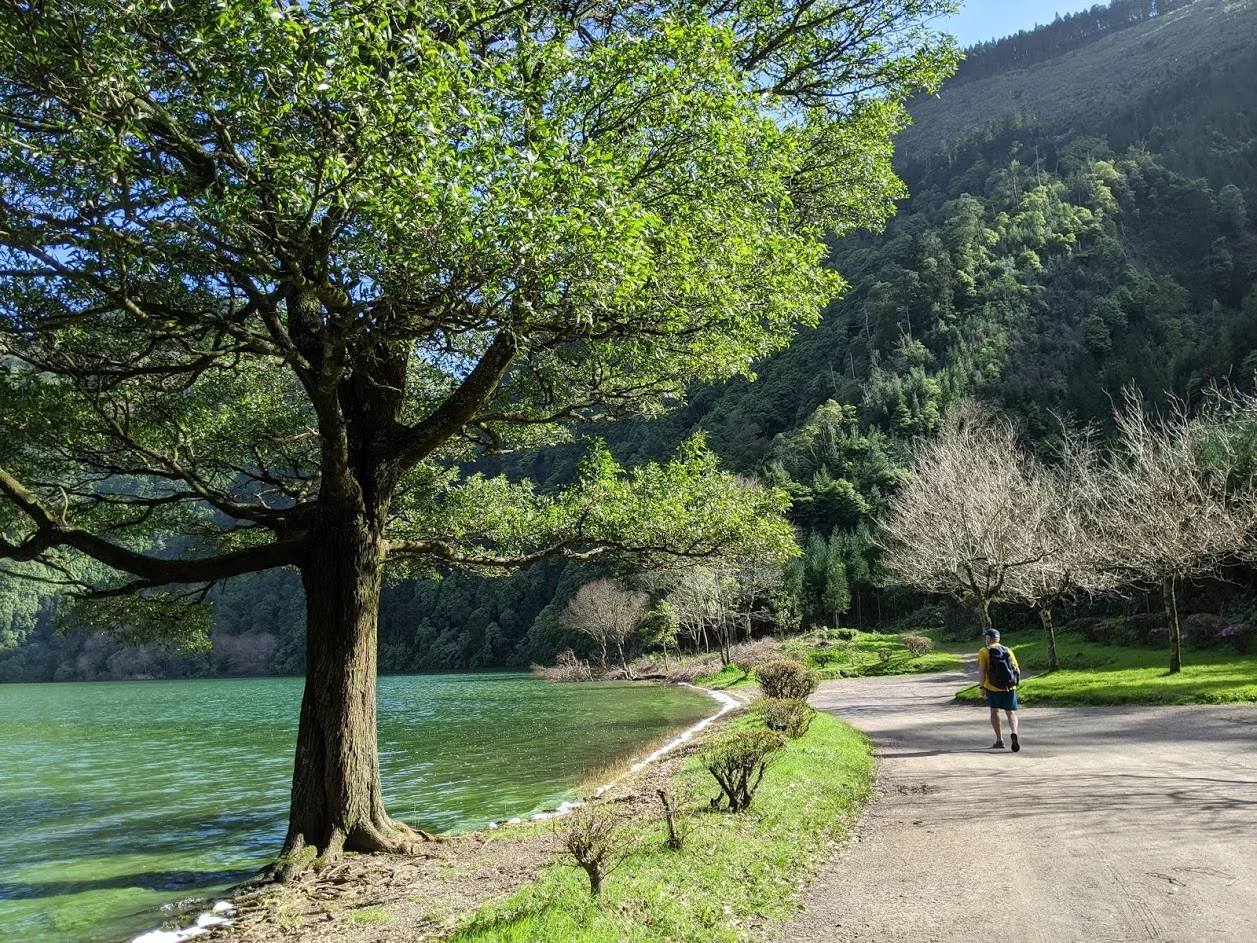
Lagoa do Fogo is most often seen from one of several overlooks high above this gorgeous crater lake. However, there is a path less travelled that took us through a jungle setting reminiscent of an Indiana Jones movie.
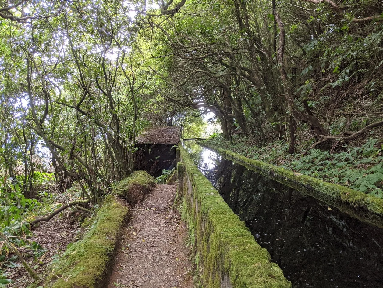
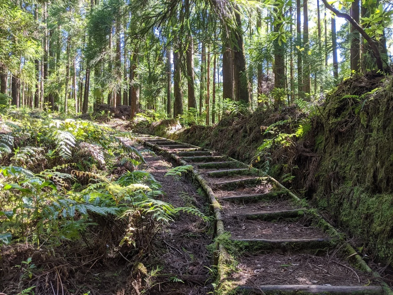
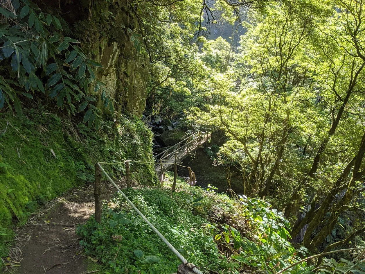
After a half-hour uphill climb through pastureland with views of the ocean we found ourselves hiking parallel to the miles-long levada (water channel) through a dense forest of Japanese Cedar and Azorean Heather along with several other endemic flora. As exotic as this setting was the feeling was amplified by the fact that there were no other people on the 11 kilometer trail to the lake.
After an hour of hiking along the levada we passed the dam that signals the entrance to the valley of Ribeira da Praia, a wide open area, with enormous brush covered slopes on both sides. Numerous water ladders and smoothly constructed channels cling to the hillsides sending runoff to the main levada.
With the afternoon sun high overhead and not a cloud in the sky the final half-hour to the lakeshore was considerably warmer that the shaded path that we emerged from. Once at the lakeshore we enjoyed our lunch as we gazed up to the lookout that first introduced us to the “Lake of Fire”.
Sao Miguel l Lagoa do Fogo Overlook
Sao Miguel l Hiking along the Levada
Sao Miguel l Lagoa do Fogo
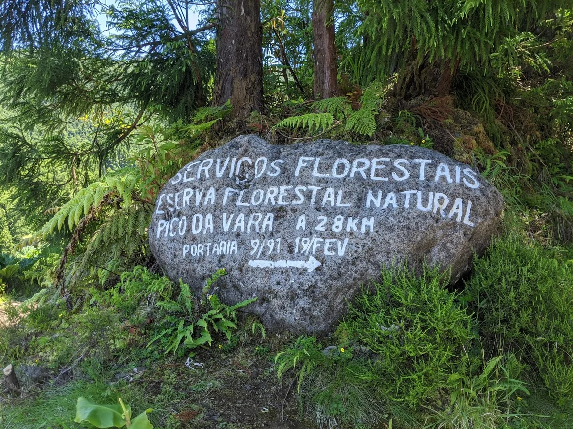
Pico do Vara l 37.8144° N, 25.2000° W
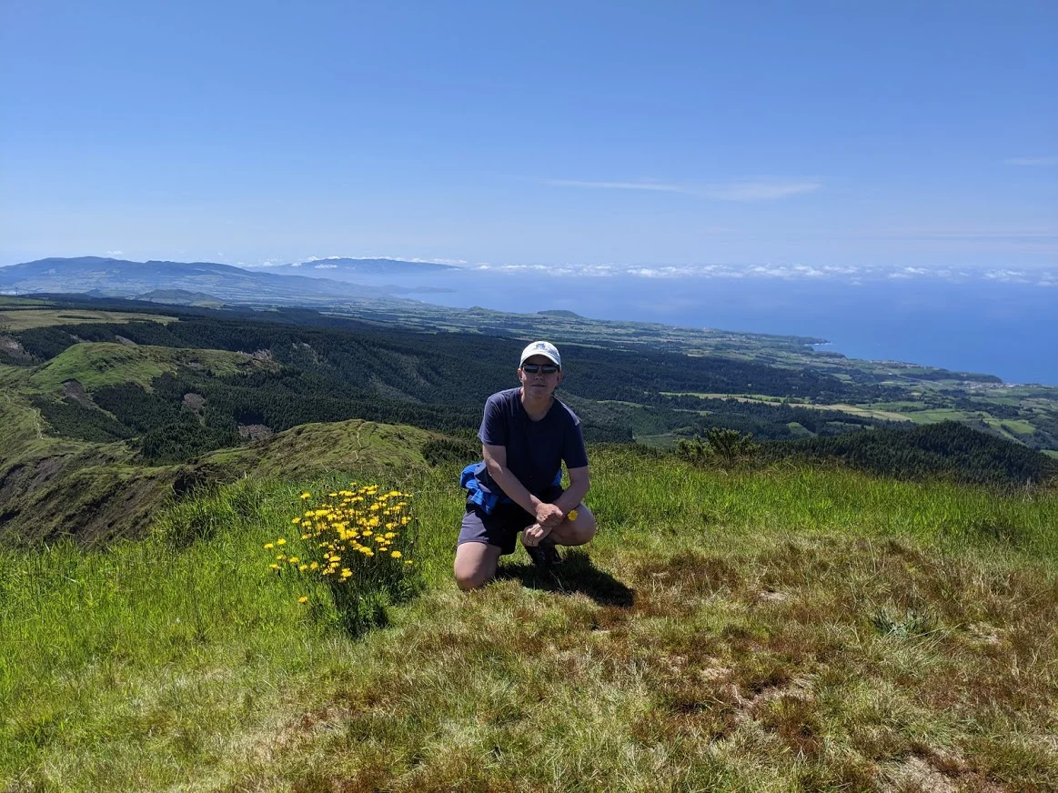
To hike to the summit of any landscape, be it a mountain, volcano or a desert sand dune ends in a feeling of elation and accomplishment. One such hike for us was Pico do Vara, the highest elevation on the island at 3618 feet above sea level.
Designated by the official Azores Trail Guide as having a round trip length of close to 15 kilometers, a difficulty level of high and an average time to complete of six hours we knew that we would have our work cut out for us when the day came.
One constant with Pico do Vara is that a high percentage of days will have less than perfect weather, thus obscuring the magnificent views. The conditions can range from a light drizzle to epic rain with gail force winds to white-out conditions due to heavy fog. To some degree the weather is dependant on the season yet a perfectly clear day to summit is considered rare.
After months of waiting the opportunity finally came in late June as the forecast called for a day of sunshine over the entire island. Like two people experiencing a bout of cabin fever we quickly packed a lunch and made the hourlong drive to our destination. True to the weather report we arrived at the trailhead with beautiful blue skies and not another person in sight.
The first hour or so we climbed hundreds of rough hewn stairs through forests of Japanese Cedar and enormous tree ferns before breaking out into wide open meadows and narrow, singletrack ridges with increasingly breathtaking views of the ocean and Santa Maria Island.
As we continued to climb the trail became steeper, with hillsides revealing numerous creases and folds that resembled the well worn lines on a fisherman’s face. In the distance coastal villages and towns appeared like tiny model train sets.
With the sun shining bright and wildflowers blooming in all directions we reached the summit where we were rewarded with 360 degree views of the island, its coastlines and the mighty Atlantic.
Breathless, we took it all in knowing that we had picked the perfect day!
Sao Miguel l Pico do Vara Trail Sign
Sao Miguel Hikes l Pico do Vara Trail
Pico do Vara l Ferni at the summit
Vista do Rei to Sete Cidades l 37° 49′ 4,32″ N 25° 24′ 8,95″ W
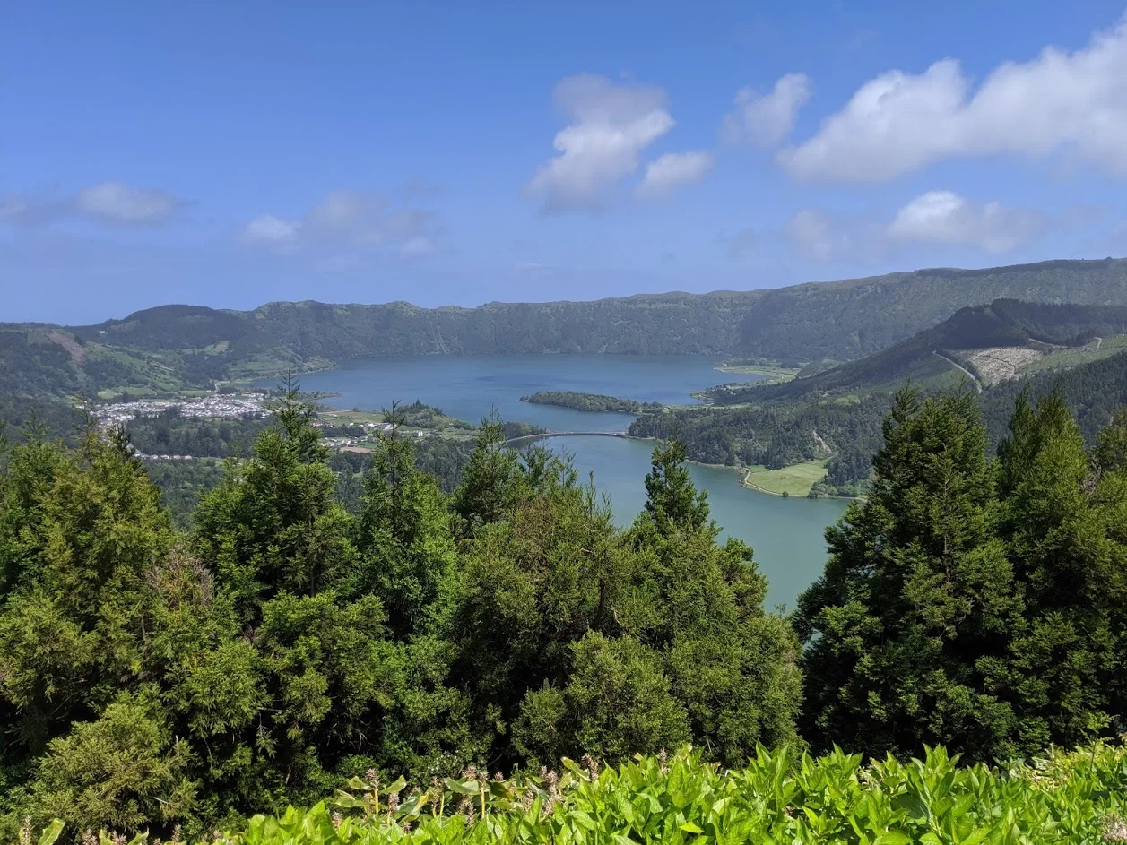
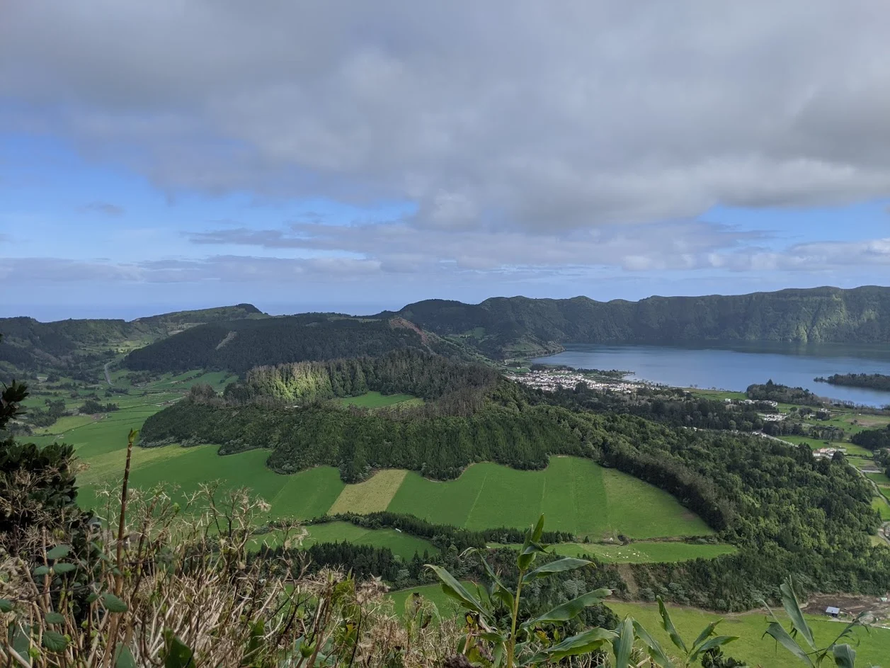
Vista do Rei, or Vista of the King, provides a breathtakingly beautiful view of the twin lakes of Lagoa das Sete Cidades along with the village of Sete Cidades. Set in a dormant volcano the scene is straight out of a middle earth movie and is easily one of the most gorgeous, and photographed, overlooks on the entire island.
Being we had yet to rent a car we took a taxi from our airbnb to the overlook. From there our plan was to hike a clockwise trail along a portion of the crater rim before coming to a road that would take us into the village. The cab driver informed us that there would be a bus in the village that would return us close to where we were staying. Being adventurous types we took his word for it, paid up and headed to the overlook.
It was a clear day and the view was absolutely amazing. With zero fog (an almost daily occurrence in the crater) there was nothing to obscure the stunning view. We could easily see well past the twin lakes to the surrounding hills, valleys, hiking trails and vegetated lava flows. The horseshoe shaped village looked like a storybook book town from a bygone era. It all seemed like some incredibly vivid dream.
Hiking along the rim allowed us to view the area from various vantage points and soon farms, cattle and the remains of numerous lava flows came into sharp relief. The landscape was beyond lush and simply took our breath away.
Once we met up with the road there was a clear walking path alongside which eventually took us to the main road into the village. This portion of the hike took another hour helping us realize just how high the crater rim was. As we slowly descended the larger of the twin lakes began coming into view. It was truly a euphoric moment.
We spent the afternoon walking along the shores of both lakes, crossing over the bridge that bisects them and leisurely enjoying the village. It was just outside the village that we discovered Quinta Da Queiró, a third generation family run farm, lodge and restaurant. This charming, restored property would become our second lodging on the island and one of our favorite stays.
After a few hours of exploring the lakes and village we found the one and only bus stop and true to the cab driver’s word the bus showed up at 4pm.
Sao Miguel l Vista do Rei Overlook
Sao Miguel l Sete Cidades Overlook
Sao Miguel l Sete Cidades Trail
Salto da Farinha hike l 37.8537 ° N, 25.2977 ° W
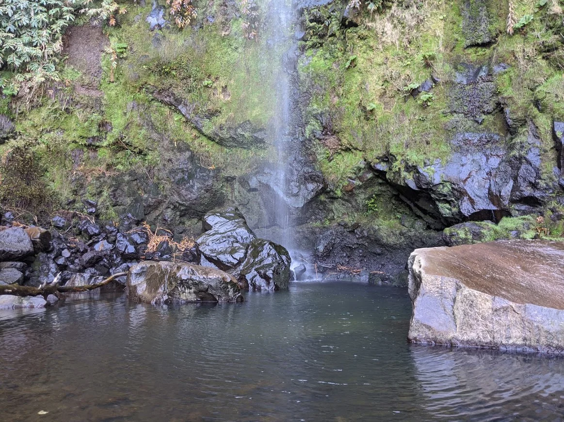
Our first excursion to the Salto da Farinha waterfalls in early 2020 was a real surprise. Not only did it have a magnificent 130 foot waterfall at the end of a deep ravine but the river that flowed from the falls ran out the ocean and a beautiful rocky beach with glorious views of the north shore of the island.
The trail to the falls was fairly easy and ran through a forest of eucalyptus and bamboo with wooden bridges crossing over the river and numerous smaller falls. Once at the main falls we were impressed by the height but not by the volume of water that we had anticipated. This was due to a relatively dry winter up to that point. Nonetheless, it was a beautiful place to rest before turning around and heading down to explore the rocky shore.
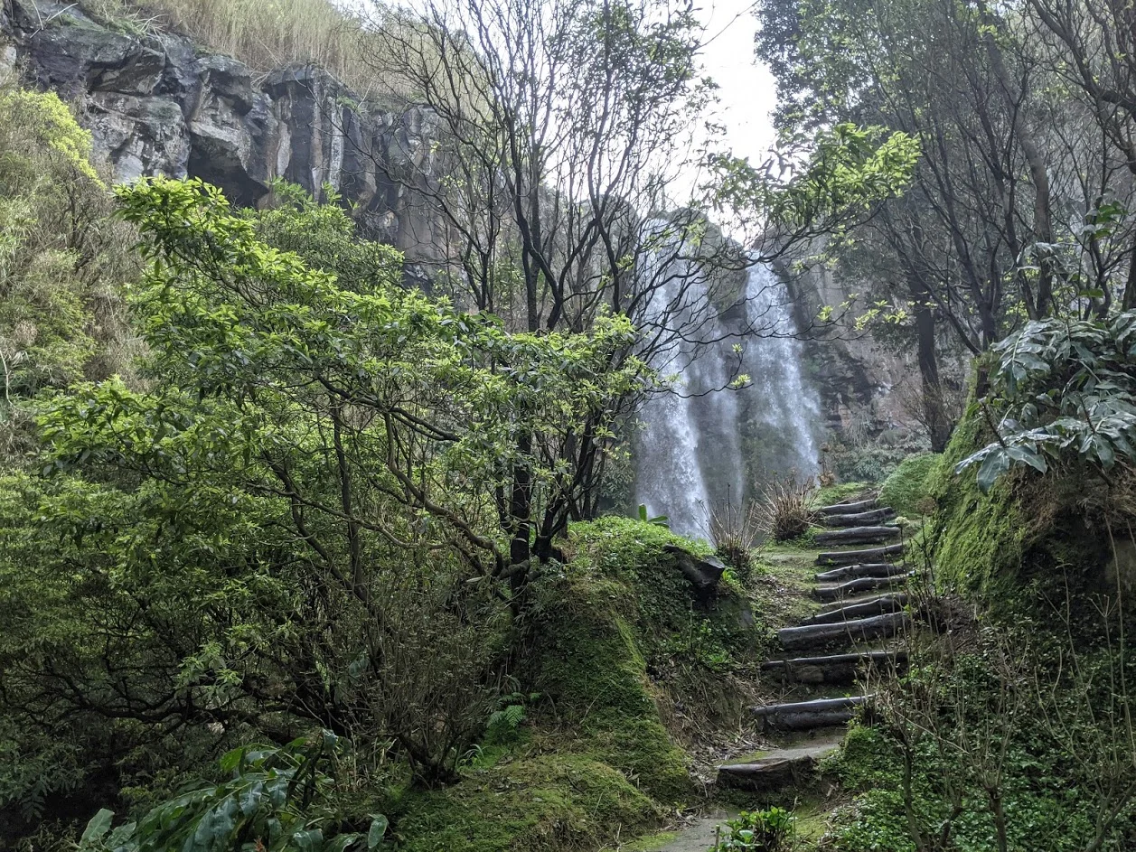
Fast forward to late January of 2021 (yes, we have been here for nearly a year!) and the falls were absolutely raging. What was a single delicate, silvery strand in 2020 was now two enormous falls split in the middle by a group of boulders at the lip of the falls. The volume of water pouring off the edge was evidence of the incredible amount of rain that the island has received over the past couple of months.
On our first visit we we were able to get very close to the pool at the base of the falls. This time around the massive volume of water and the spray that it created stopped us at a rocky outcropping 50 feet away. Any closer would have drenched us in a horizontal blast of spray.
After our misty encounter with the swollen falls we spent the next hour or so following a trail into higher ground that ran along the river where we discovered several tributaries along with additional falls. The twin falls were awesome to witness yet seeing the amount of water above the falls was equally as impressive.
What a difference a year, and several months of heavy rain, can make.
Sao Miguel l Salto do Farinha Bridge
Sao Miguel l Salto do Farinha Falls
Sao Miguel l Approaching Salto do Farinha Falls
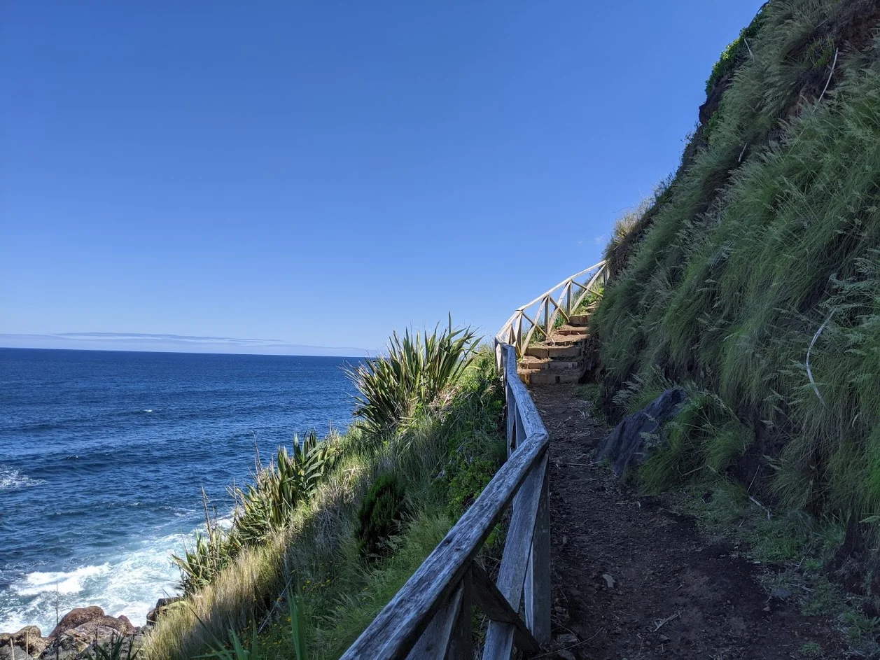
Praia da Viola hike l 37.8387° N, 25.3677° W
The Praia da Viola hike was an instant favorite the first time that we did it. This route connects the parishes of Lomba da Maia to Maia as it passes through farmland, potato fields, vineyards and the ruins of several ancient watermills. We experienced all of this wonderful scenery while overlooking the north coast of the island.
After passing several of the old watermills we came to a shaded viewpoint with amazing views up and down the north coast. On the cloudless day with warmer than normal temperatures the viewpoint was truly the relief we needed before resuming our journey.
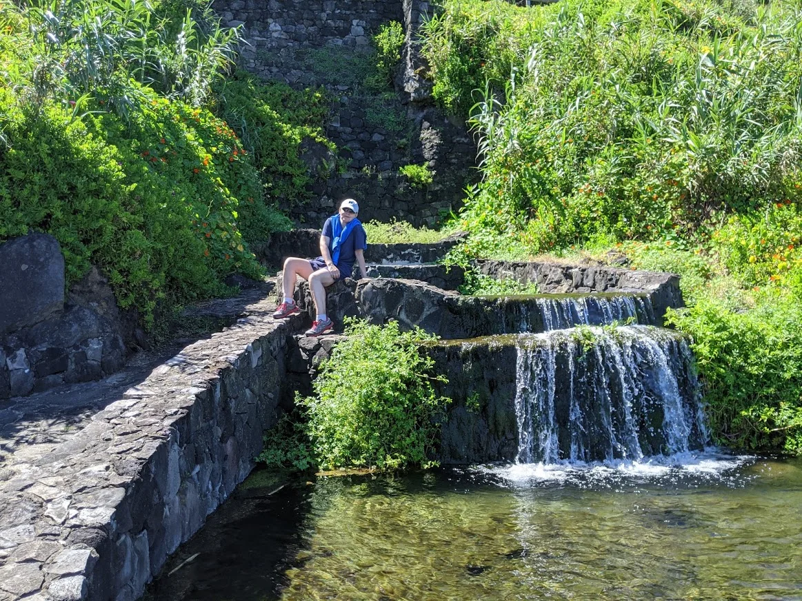
Back on the trail we encountered only two other people during our four hour outing. They were local gentlemen farmers tilling and planting a small plot of land with potatoes. With our limited command of Portuguese we exchanged universal pleasantries and pressed on. Shortly after meeting the farmers we came across several large man-made stone pools that were terraced into the hillside and fed by a waterfall. In days past these freshwater pools were used by the women of the nearby parish to wash their clothes while catching up on some local gossip.
Before too long we came to an intersection in the trail. Straight ahead would take us to the other starting point for the trail beginning in a different parish. Heading down a long, serpentine flight of stairs would take us to Praia da Viola which is considered by islanders to be the most pristine beach on the entire island. We were about to find out just how pristine.
The steep stairs down only served to remind us how high above the ocean the trail actually was. The majority of the descent to the beach was bordered by ruins of the ancient watermills of Viola. Moved by the force of a nearby stream these mills transformed local wheat and corn into flour used in making bread, a staple of food for countless families. Though they are no longer functional it was easy to envision man and nature working together in one of the most beautiful settings.
The last flight of stairs to the beach were a bit beat up but as we landed on the fine black sand we were blown away by the remoteness and beauty of this sliver of paradise. It was simply stunning, with several waterfalls dropping lazily out of the cliffs creating glistening rivers that ran to the ocean. The feeling of isolation was made all the more prominent due to the fact that we were to only people on the entire beach.
Currently living in Richmond Hill, Georgia Jim continues to travel the world in search of unique stories involving adventure, architecture, culture, food & markets, people and the most beautiful places on earth.


