Iceland is an exotic land, and landscape, that is best experienced on foot. During our 2-week stay we were blessed with unusually good late fall weather allowing us to comfortably explore many parts of this glorious island. Here are our six favorite iceland hikes.
Thingvellir National Park is located along the route known as the Golden Circle, a 140 mile loop beginning and ending in Reykjavik. The road takes in stunning countryside, huge spouting geysers, thundering waterfalls and dramatic cliff faces.
Although the entire 140 mile loop can be managed in under four hours we decided to make a whole day of this majestic drive so as to immerse ourselves in the natural wonder that Iceland is known throughout the world for.
Our first stop was Thingvellir National Park and the thundering waters of the Öxarárfoss waterfall. Thingvellir National Park has the unique distinction of being the meeting point of the North American and Eurasian tectonic plates, which creates some stunning geological features. It is also the only place in the world where the Mid-Atlantic Ridge is visible on land along with an enormous sheer cliff face that’s actually the corner of the North American continent.
As we entered the park it created an otherworldly feeling to realize that we were were actually walking between the tectonic plates of North America and Europe.
These tectonic plates separate at approximately 2.5 centimetres (nearly an inch) a year and have done so for millenniums. The effects of this movement are very clear within the park as lava fields fill the valley, from magma that welled up as the continents spread. The entire area is littered with ravines, ripped open by centuries of earthquakes.
This is an epic and dramatic landscape made more so by the enormous, multi-tiered Öxarárfoss waterfall which is the only man-made waterfall in all of Iceland. As strange as this may sound geologists and historians have discovered that the river Öxará was moved hundreds of years ago, to channel the water into the Almannagjá ravine in the ninth century. The purpose was to provide water for the members and visitors of the Icelandic parliament when they held court in this magnificent spot.
Mesmerized by the sheer size and beauty of this place we found ourselves lingering and exploring considerably longer than the average visitor. We hiked for hours along several trails while enduring incredibly strong winds. As we navigated our way to the various lower overlooks plumes of mist swirled upward in every direction while spray coming off the falls made it all but impossible to stay dry.
In 1930 Thingvellir National Park was established as Iceland’s first national park. It has also been recognized as the only UNESCO World Heritage Site in Iceland. One visit to this remarkable place was all it took to make us realize why these designations have been bestowed on this amazing place.
Wet and windburned we headed back to the car with our first day in Iceland seared into our hearts.
Thingvellir National Park l Epic waterfalls
Thingvellir National Park l Epic waterfalls
Pverfellshorn | 64.9631° N, 19.0208° W
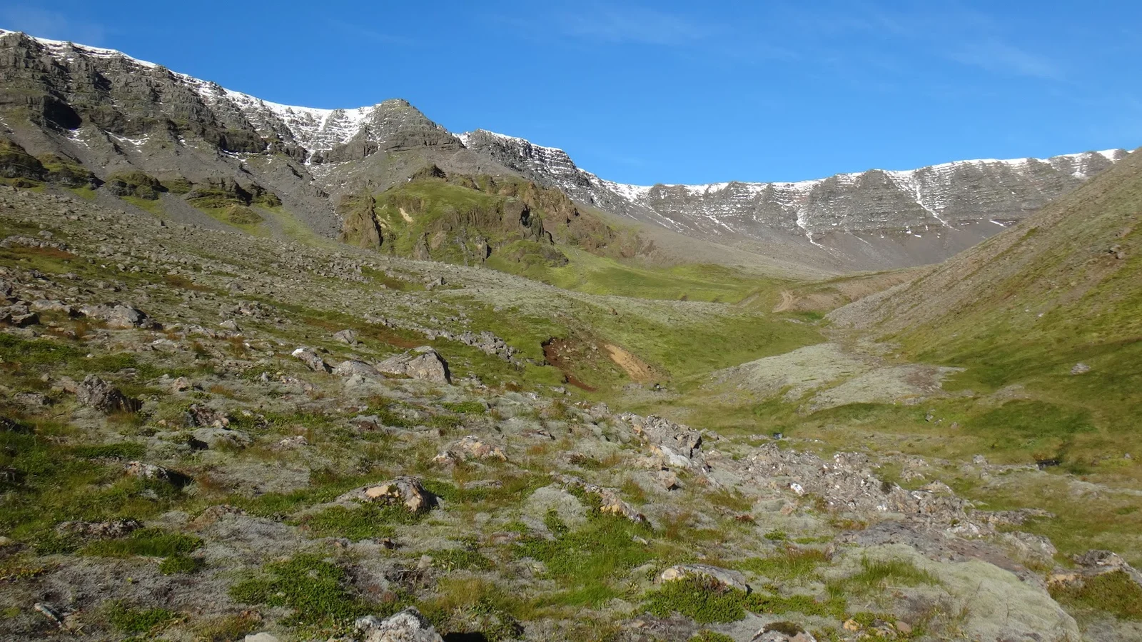
Pverfellshorn is among several peaks in the flat-topped mountain known as Esja (often called Esjan) and is one of Iceland’s most popular destinations for day hiking. It is clearly visible from across Faxaflói Bay making it the most dominant feature of the capital’s skyline. In reality, Esja is not a true mountain, but a volcanic range, the highest peak of which reaches 914 metres (2,999 feet) high.
Our goal during this second outing of our trip was to make the summit of Pverfellshorn (2560 feet) and witness the amazing views over the lowlands and across the bay to Reykjavik. As day hikes go this proved to be a good driving-to-hiking ratio as the distance from from our apartment in the city to the trailhead was only six miles.
Less time driving. More time hiking. Turned out we would need the extra hiking time.
Knowing that this was one of the more popular day hike destinations we were surprised to find that we were the only car at the trailhead. Travelling anywhere in the off season has distinct advantages and our outing to Pverfellshorn proved that once again.
Once on the trail we noticed that the path is divided into sections, marked with signs along the way. Each sign gives an indication of the difficulty of the path ahead with a grade system ranging from 1 boot (easy) to 3 boots (challenging).
Initially we stayed to the left of the river as the path was open and gradual yet increasingly strenuous. There was no doubt that we were climbing. The visibility was incredible, allowing us to see not only the peak at Pverfellshorn but beyond to the highest, snowcapped, point on the mountain. The air here is rarified with zero pollution and we filled our lungs to capacity.
Halfway up the mountain we encountered a fellow hiker as he was heading down. He cheerfully shared with us that this was his daily hike and that he had been doing it for decades. In and of itself that would have been amazing until he informed us that he was 90 years old.
We need to get out more!
Two hours later we reached (and caught our breath!) the overlook known as Steinn (rock in Icelandic). From Steinn to the final summit the path becomes considerably more steep where a series of fixed ropes are required to complete your journey.
With the wind taking charge, the temperature dropping and over 4 miles of hiking with 2000 feet of altitude gain, we decided to make Steinn our turn-around point and headed down the mountain.
Returning on the left side of the river we traversed a moonscape of volcanic boulders laying on emerald green beds of field grass preparing for their winter rest.
Heading up to Pverfellshorn
Heading down from Pverfellshorn
Skaftafell National Park | 64.0704° N, 16.9752° W
Words simply cannot describe Skaftafell National Park. Statistics maybe…but words are hard to find.
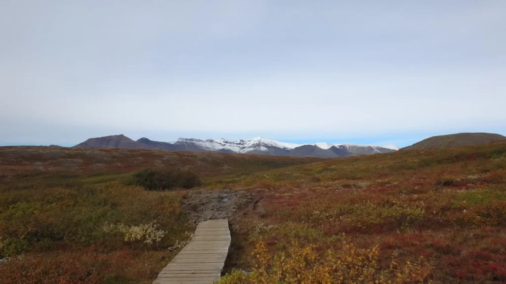
Located on the South East coast it holds in its arms Vatnajökull glacier, the largest in Europe, as well as some of the highest peaks in Iceland. On a clear day the mountains start coming into view from over 50 miles away. The park simply owns this corner of Iceland.
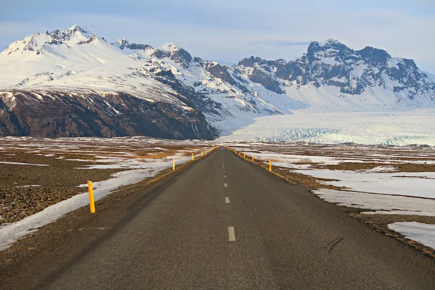
Being that Skaftafell is roughly 203 miles from Reykjavik it is really not suitable for a day trip from the city as even in the best weather and road conditions it can take 4 hours just to get to the entrance of the park. This is especially true considering all the beautiful stops that will distract travellers from a straight 4-hour run.
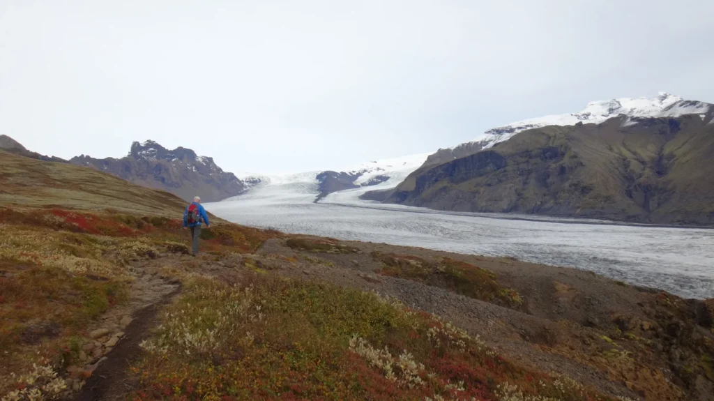
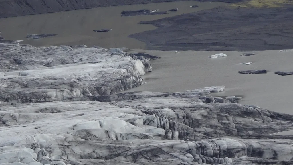
Fortunately for us we had been staying in Lambafell which is only 90 miles to Skaftafell, making the park on the way to Lake Mývatn, our next overnight destination. We set out in the early morning to take in some sights along the way with the goal of arriving at Vatnajökull glacier by late that morning. Vatnajökull glacier is a mind bending amount of ice to witness and explore. There are numerous activities available including glacier hiking (not allowed without proper gear and a guide), ice climbing, bird watching and trekking. Being that we did not have a guide we were content to hike along the network of trails allowing us the chance to get very close to the ice.
Many glaciers appear blindingly white from a distance only to reveal themselves when seen up close to be covered in layers of cryoconite, a windblown dust made up of small rock, soot and microbes. Another contributing factor comes as the result of ash fallout from volcanic eruptions. On our hike as we saw crystal blue ice on bottom sections of the glacier and various icebergs while the tops were covered with soot. What appeared to be pristine from far off was a dirty ice field warming and dripping in the late morning sun, albeit beautiful in its own way.
The rugged landscape, mountains and glaciers of Skaftafell had an absolutely hypnotic effect on us. It was difficult to leave yet we knew that darkness arrives early this time of year and our next stop, the glacier lagoon, awaited.
Skaftafell National Park
Skaftafell National Park l Trail
Skaftafell National Park l River of Ice
Skaftafell National Park l Glacier meets lagoon
Jökulsárlón Glacier Lagoon | 64.0784° N, 16.2306° W
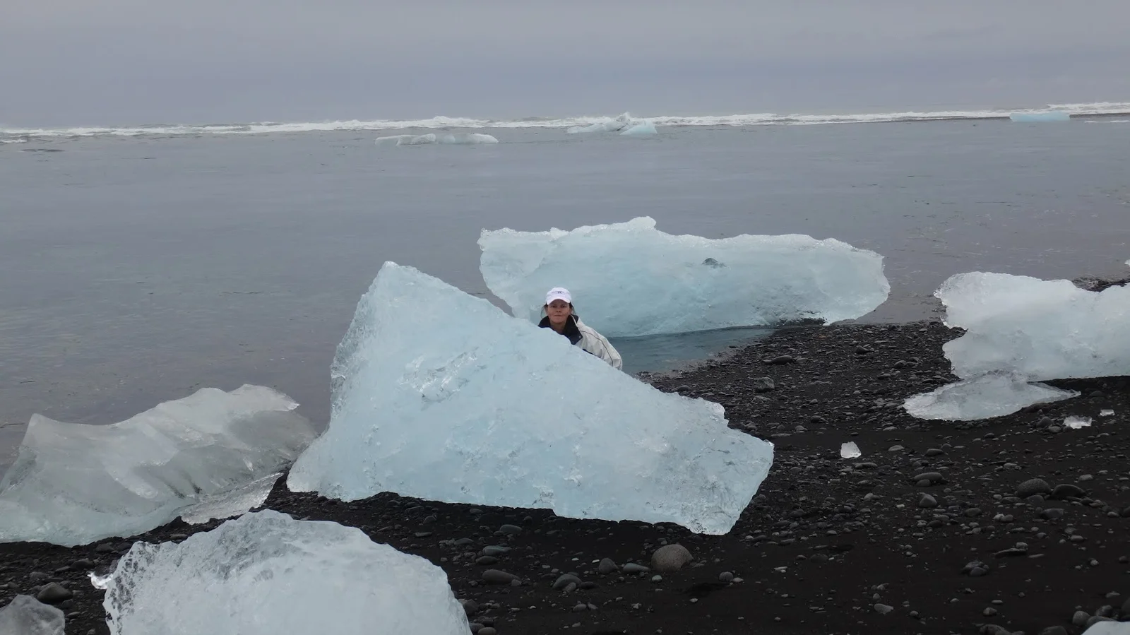
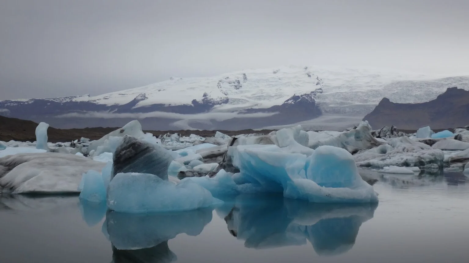
Leaving Skaftafell National Park was a short (35 mile) drive east on the Ring Road to the glacier lagoon known as Jökulsárlón. Often referred to as Iceland’s Crown Jewel, Jökulsárlón is situated on the southern part of Vatnajökull glacier and is fed by meltwater from the glacier tongue known as Breiðamerkurjökull.
The glacier tongue also supplies the lagoon with hundreds of enormous icebergs, which perpetually break off from its tip and tumble into the water. On average they float for about five years until they are small enough to make their way towards the sea. When they finally do escape the lagoon, many join the countless smaller ice chunks that adorn the nearby Diamond Beach.
On the afternoon that we arrived there were very few tourists and we spent the better part of an hour in near solitude as we walked the banks of this incredibly beautiful and surreal lake. We were stunned to see massive chunks of ice floating in the lake in multiple shades of blue that defy description. Other chunks were pure white, while some were as clear as an ice cube. Many had a black coating or black in their fissures, the result of volcanic ash fallout from past eruptions.
Off in the distance the mountains loomed, enveloped in their perennial blanket of snow while the massive glacier continued its incremental march toward the lagoon. Moving across this vast landscape were telltale signs of a winter storm as clouds obscured our view and the temperature began to drop.
We headed across the road from the lagoon to Diamond Beach to witness firsthand the bergs migrating through the narrow passage where they either drift out to sea or wash up on the nearby shore. Once they land on the black sand they glisten like oversize diamonds small enough to hold in your hand or enormous sculptures as clear as Swarovski glass. It is nothing short of a photographers dreamscape.
It was a riotous affair watching the bergs as they rolled, tumbled and slammed into one another while the incoming waves did their best to prevent them from entering the ocean.
We marveled at the chaotic scene playing out, took numerous photos then headed out for our next adventure…the famous, and not for the faint of heart, Oxi pass.
Jökulsárlón lagoon
Jökulsárlón lagoon
Jökulsárlón lagoon l Ice sculpture
Jökulsárlón lagoon l Ice sculpture l Massive chunks
Lake Mývatn | Hverfjall Volcano | 65.6039° N, 16.9961° W
The many natural wonders of Iceland are like nothing we had ever seen before in our travels and Lake Myvatn takes it to any entirely different level.
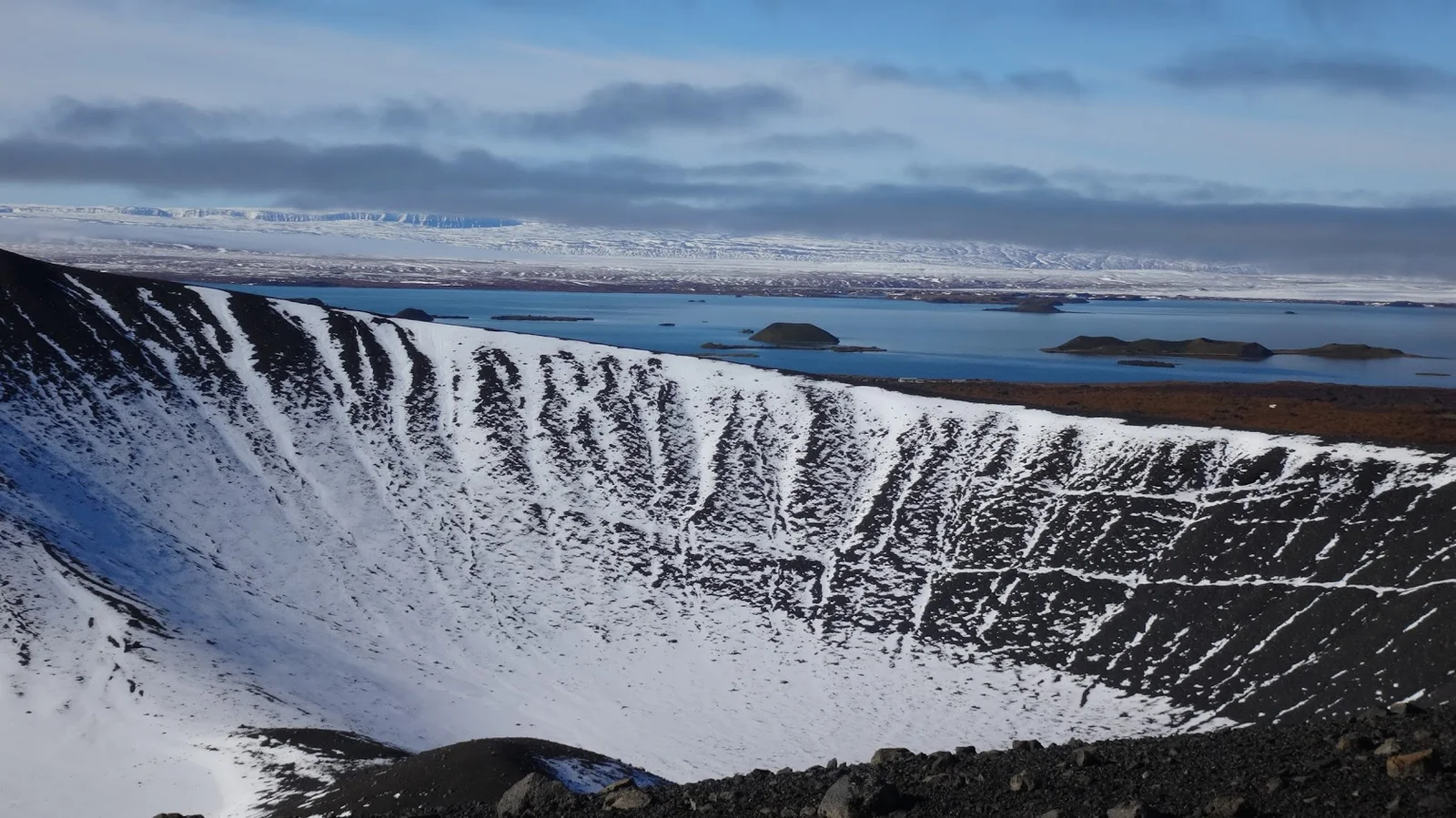
Lake Myvatn is not a lake in the classic sense of the word with sandy beaches and boats zig-zagging from shore-to-shore. Instead the entire Myvatn area, including the lake, is a virtual moonscape of spent volcanic cones, many of which are inside the lake itself!
With an area of roughly 15 square miles lake Myvatn is Iceland’s fourth largest body of water although its size is just one of the fantastic qualities it possesses. The lake is not fed by melting glaciers or rivers but was formed, 2300 years ago, when a series of volcanic eruptions created a large lava field which blocked a nearby river.
Being that we were lodging at a farm resort close to the lake we had ample time to get out and explore the extraterrestrial landscape in, and around the lake. Among several hikes we took one of our favorites was the rim trail of Hverfjall, a tuff ring volcano with an incredibly impressive crater. It is rare to be able to view inside a dormant volcano and even more rare that we were able to walk around the entire snow-covered rim.
The views inside the volcano and the surrounding Myvatn area were stunning to behold. It was breathtakingly bizarre and one of those surreal moments when it is hard to wrap your head around exactly what you are seeing.
Observing the lake and surrounding area from this elevation it was easy to mistake the numerous cones in the distance for more volcanos or even small islands. An afternoon hike to the other side of the lake not only revealed the awesome power of the Hverfjall volcano but helped to clear up our misperceptions.
Boulders ranging in size from a fist to considerably larger were evidence of the debris range that this massive volcano covered. Cones that we mistook for small volcanos were instead massive impact craters from boulders smashing into the ground, their burnt rims evidence of the enormous heat.
The land of “ice and fire” is on full display in this vast region.
Hverfjall Volcano
Hverfjall volcano
Heading into the Hverfjall Volcano
Námafjall Geothermal Area | Hverir | 65.6409° N, 16.8093° W
Impact crater from the Hverfjall volcano
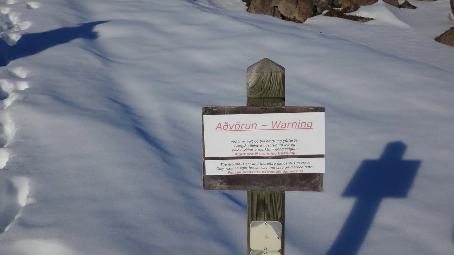
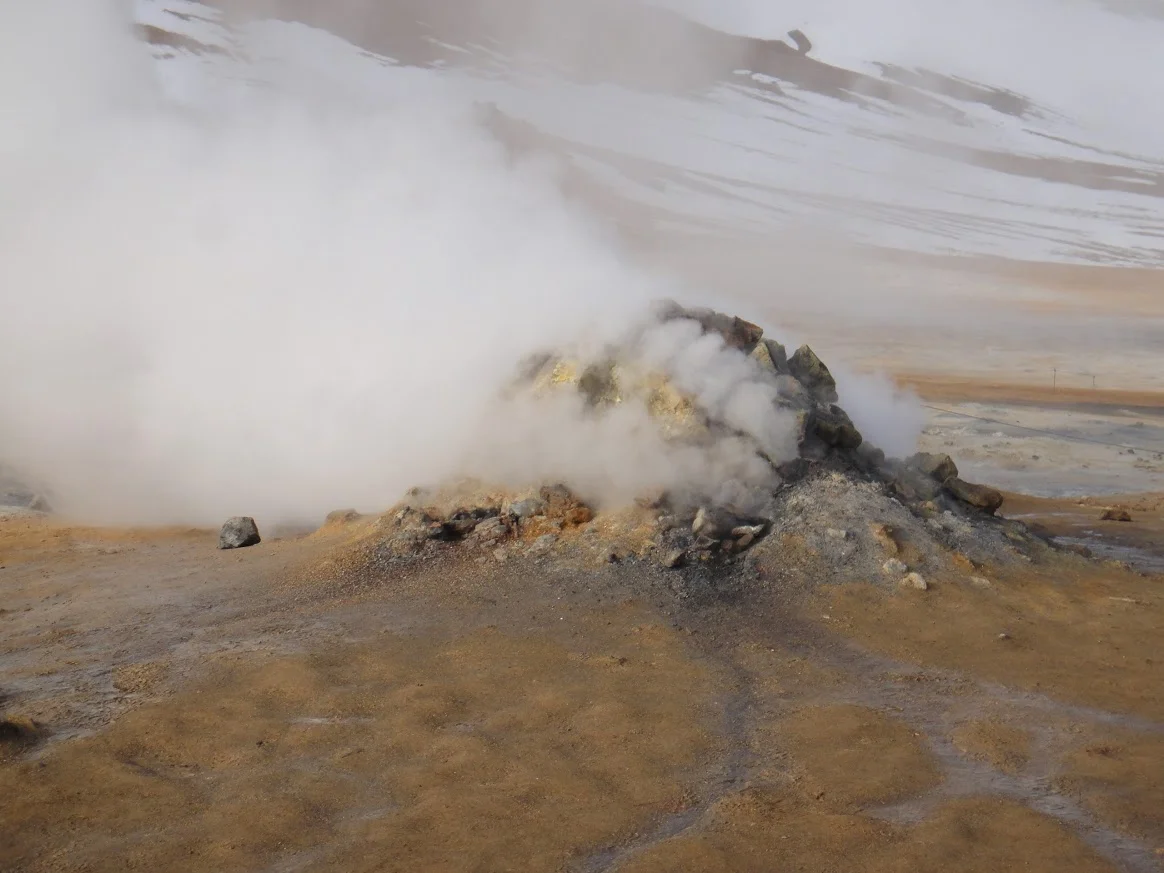
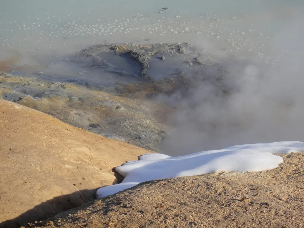
Located a few miles northeast from Lake Mývatn lies the Mars-like geothermal area known as Námafjall Geothermal Area.
As soon as we exited our car we could smell this place before we ever laid eyes on the dozens of smoking fumaroles, boiling mud pots and small rivers of intensely hot water. To say it had the smell of rotten eggs would be an understatement.
Among the many things that struck us about Námafjall was the sheer lack of vegetation. The constant emission of fumes has made the ground utterly sterile and acidic, unfit to sustain any flora or fauna. Although Námafjall doesn’t have a geyser like some places in the south it has several very active fumarole chimneys. These fumaroles are mounds that bubble, hiss, and spew steam, sometimes in copious quantities.
Although this was not one of our more difficult hikes the otherworldly setting, noxious smell, heat and beauty of the colourful minerals was well worth the detour. With the perpetual fog created by steam meeting the cold air it was an eerie site and the spectrum of blues, greens, yellows and reds made it feel as though we had landed on another planet.
Currently living in Richmond Hill, Georgia Jim continues to travel the world in search of unique stories involving adventure, architecture, culture, food & markets, people and the most beautiful places on earth.


